 How Mountain Bikers Are Saving the World by Mapping It Download PDF
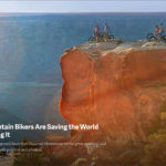
Five days in the proposed Bears Ears National Monument reveal great potential and many challenges, both political and physical.
SOUTHEASTERN UTAH—On a brisk, clear morning in early October, the autumn sunlight surges into Arch Canyon and sets the sandstone cliffs on fire, transforming the 250-million-year-old rock into blinding amber. A creek meanders through the chasm, producing a faint trickle. Moisture here is rare. But a spell of intense rainfall recently spawned a sudden oasis, reviving the cottonwood stands huddled beside the riverbed. I’m riding a mountain bike, exploring a trail where loose sand and frequent stream crossings make forward movement difficult. I’ve covered just three miles in an hour—glacial by mountain-biking standards. My shoes are soaked and full of grit, and I should probably turn back. Instead, I clamber onto a smooth, flat-topped boulder 10 feet above the canyon floor to have a look around.
From here, it’s easy to picture the Anasazi Indians who first inhabited this place, establishing their earliest settlements some 2,500 years ago. That’s because their dwellings remain. A handful are scattered throughout the canyon: I spot one from where I’m sitting—a compact clay and stone adobe erected on a narrow ledge called Jailhouse Ruins. In the surrounding wilderness are many other relics—petroglyphs and rock paintings, kivas and pit houses, gravesites, and countless other artifacts.
Historians who study the Anasazi, also called Ancient Puebloans, believe that southeastern Utah is the most archaeologically dense region in North America. By some estimates, the area has more than 100,000 Puebloan cultural sites, some dating to 12,000 B.C. Whether or not looters ransack them is often a function of how far they are from the nearest roadway. Some are a short walk; others demand strenuous multiday hikes through desert badlands. Hundreds of ruins have already been vandalized and artifacts stolen: Looters have carted away priceless pottery, chiseled off petroglyphs, and dismantled entire dwellings. Rangers have even discovered bullet holes in 1,800-year-old rock art.
Native Americans are understandably worried, especially with 75,000 people visiting the area annually; the figure is expected to steadily rise. In July 2015 the Hopi, Navajo, Uintah and Ouray Ute, Ute Mountain Ute, and Zuni tribes—all of whom trace their ancestry to the Puebloans—partnered to form the Bears Ears Inter-Tribal Coalition. Three months later they submitted a 40-page proposal to President Barack Obama, asking him to establish the Bears Ears National Monument. They want to protect a whopping 1.9 million acres—almost three times the size of Yosemite National Park—from the Lockhart Basin near Moab, Utah, to the San Juan River, just north of the New Mexico state line.
The monument gets its name from a pair of twin buttes, the Bears Ears, that rise 2,000 feet above the expansive Dry Mesa and Grand Gulch, habitat of mountain lions and antelope and bighorn sheep, ferruginous hawks and hairy woodpeckers, and other fauna and threatened species. The tribal coalition is not only passionate about safeguarding what’s left of its fractured history; it’s also determined to preserve a place where Native Americans are deeply entwined. Within the proposed monument, tribes still perform traditional rituals, collect medicinal herbs, gather ceremonial firewood, and hunt big game.
With his signature, President Obama can use his executive powers under the Antiquities Act of 1906 to proclaim the area a national monument—a designation permanently preserving it that legal scholars say would be almost impossible for a Trump administration to reverse. Assuming Obama acts, which close observers expect he will, knowing that Trump will surely abandon the tribes’ proposal, Bears Ears would become the second-largest national monument in the U.S., about half the size of Connecticut. (The Papahānaumokuākea Marine National Monument, near Hawaii, is the biggest but encompasses mostly ocean.)
While a national monument would bring a bustling (though seasonal) tourism economy to the area, local support in surrounding San Juan County is mixed. Tribes with ancestral ties to Bears Ears would undoubtedly celebrate: Not only would it be by far the largest swath of ancestral Native American real estate set aside for permanent protection, but it would give tribes direct management authority over federally protected lands. The proposal stipulates that, in a historical first, Native Americans would serve on a joint commission alongside representatives from the United States Forest Service and the Bureau of Land Management.
The opposition—voiced primarily by the three-member San Juan County Commission—insists that the monument is overkill. Currently, the Forest Service and the BLM oversee almost all the land within the proposed monument, and the agencies are managing it just fine, argue monument detractors, suitably balancing preservation and recreational demands with the need to generate jobs in Utah’s poorest county, where the median income is just 61 percent the national figure, and the unemployment rate is 7 percent. Though any existing energy leases would be honored, a national monument, they correctly point out, would prevent any expansion of those leases, or any new development whatsoever of certain industries, including potash mining and oil and gas drilling.
I’m in Bears Ears with a dozen mountain bikers from a company called Adventure Projects, which REI purchased last year, the retail co-op’s first-ever acquisition. Adventure Projects, cofounded by 44-year-old Nick Wilder, produces GPS-based trail guides that users can access through sport-specific smartphone apps. So far, the four-year-old outfit, based in Boulder, Colorado, has mapped 24,546 rides in 30 countries, totaling 87,096 miles, for mountain biking. (The company also covers climbing, hiking, running, and backcountry skiing.) Wilder’s users contribute routes, typically using the GPS function on their smartphones to track rides and then uploading the data to the Adventure Projects website. Wilder and his wife, Megan—along with their family and friends (including myself)—have helped map hundreds of trails. Yet the area around Bears Ears was largely blank space on Adventure Projects’ mountain-biking app, called MTB Project, which prompted Wilder to bring most of his staff from Boulder to Utah to investigate potential new trails. The motivation wasn’t solely to beef up the database. “There’s lots of evidence that when people care about a place, they want it protected,” Wilder tells me. His users, devoted to outdoor recreation, have garnered support for conservation efforts in areas with popular rock-climbing and mountain-biking routes.
Bringing more riders to Bears Ears, the thinking went, would get people excited about the area—and, with luck, encourage them to back efforts to preserve it. Last year, the BLM was in the process of renewing oil and gas leases near Cortez, Colorado—an area popular with mountain bikers. Adventure Projects got involved, providing rider statistics drawn from MTB Project to the International Mountain Bicycling Association, an advocacy group. “IMBA took our data to the BLM and convinced them to make changes to their plan to reduce the impacts to the trail system,” says Adventure Projects cofounder Michael Ahnemann.
What none of us realized before arriving in Bears Ears, however, was just how contentious the debate over the monument had become. After a short respite contemplating the solitude in Arch Canyon, I begin the muddy slog back to our campsite. A week later, Josh Ewing, executive director of Friends of Cedar Mesa, one of several grassroots organizations partnering with the tribal coalition to promote the monument, tells me about a flier someone posted at numerous trailheads in Bears Ears. It declared that “hunting season” had begun on “backpackers” in San Juan County, an obvious warning to visitors like us. “There is no limit on how many may be harvested,” it noted. “Any weapon may be used.” Phil Lyman, chairman of the San Juan County Commission, called the fliers “repulsive” and denounced anyone who would advocate violence. At the same time, he accused a pro-monument group of generating them—a tactic, he said, aimed at turning public opinion against his opposition campaign.
On our first morning in Utah, a single sharp crack—a gunshot—punctuates the dawn silence. Thankfully, I know nothing yet about the threats to outsiders who might want a national monument here. We’re camped in the northern section of Bears Ears, in grassy meadow called Buckboard Flats. I unzip my tent and thrust my head into the damp morning air to find six mule deer staring back at me. The rest of our group is still asleep. But this being the first day of hunting season, everyone else in the campground is already awake, sporting head-to-toe camouflage and big-bore rifles. Another boom echoes off a nearby peak and spooks the deer, which scurry into the woods. We’re just below Horsehead Peak (11,209 feet), the second tallest in the Abajo Mountains. Its flanks are mottled with luminous orange aspens in full-blown autumn color.
Wilder appears and ignites a portable propane stove to boil water for tea. After a group breakfast, he gathers us around a long picnic table to hash out the day’s strategy with Ahnemann. Wilder unfolds two large waterproof topographic maps that have been marked up with a pink highlighter. “We’re going to split into five groups,” he tells us, pointing to the maps. There are four options for mountain biking; the fifth route is a possible hike. Wilder warns us: “Some of these trails could be very challenging. But at this point we really have no idea what we’re going to find.”
Wilder is going to scout a place called Robertson Pasture. While it sounds benign, it’s actually a grueling, slippery mountain-biking assault that climbs above the treeline. I’ll be biking with Joel Gratz, a friend and meteorologist from Boulder who runs a snow-forecasting company, and our photographer, Westin Fuller. Our plan is to circumnavigate Horsehead Peak and then rendezvous with Wilder’s team on its southern flank to finish the afternoon together on a gentle descent back to camp.
Heavy dark clouds threaten rain when I get under way with Gratz and Fuller. I launch Gaia GPS, a third-party app on my iPhone that tracks our distance, speed, and elevation gain and loss. Wilder’s group uses the MTB Project app, which functions similarly. After a short stint on pavement, we veer onto a hardscrabble dirt road that ascends in switchbacks from Buckboard Flats. The terrain is nothing like I expected. Southeastern Utah is renowned canyon country—a contorted labyrinth of stratified slickrock, teetering hoodoos, dwarfed stands of gnarled juniper, and wind-scoured mesas. But the lofty Abajos are an anomaly, verdant and thickly forested like the pitched-alpine slopes in neighboring Colorado.
After five miles, we reach our high point: North Creek Pass, which, at 10,300 feet, has a view of the largely uninhabited Manti-La Sal National Forest—some 1,900 square miles within the proposed monument. To get my bearings, I check my iPhone, which I’ve loaded with high-resolution topographic maps of the region. Directly to our south, the desert emerges from the rugged Abajos. From where we’re standing, an abrupt transition is visible—from timbered peaks to treeless canyonlands. It occurs along an east-west line that adheres closely to the Manti-La Sal’s southern border. Seeing it from above clarifies why opponents to the monument want the northern Manti-La Sal section removed from the monument. A third is already protected inside the Dark Canyon Wilderness; the rest, claim those opposed to the monument, including commissioner chairman Lyman, holds less cultural significance to Native Americans because there are far fewer archaeological sites than there are in the southern section.
All sides agree that Bears Ears needs protection. The debate is whether monument designation would be a case of the federal government overreaching when, instead, it should leave resource management to the state and the county, where a symbiotic partnership with the Forest Service and BLM exists. The proposed monument is just too big, opponents say, and while they haven’t proposed a different set of borders, the feeling is that some aspect of the northern section should be left out. They argue that a monument will only bring more people to the area, and hence, more looting—which has happened at Grand Staircase–Escalante National Monument, also in Utah. Then again, monument status would garner more money and resources from the feds to combat looting. Environmentalists are generally opposed to any drilling and believe federal protection will help preserve the area’s archaeological sites and wildlife. For Native Americans, the monument is hugely symbolic—they’ve never had such a massive area preserved while also being given management authority over it.
San Juan County Commissioner Rebecca Benally is the de facto leader of the monument opposition. She voices her objections primarily through a website called Save Bears Ears. Benally claims that Utahans and Navajos don’t want the monument. But recent polls show that up to 70 percent of state residents support the initiative, and six of the seven Navajo chapters have endorsed it. (Another 21 tribes in the Southwest are also on board, as is the National Congress of American Indians, which represents 225 tribes throughout the U.S.) Emails and voicemails to Benally were not returned. The Sutherland Institute, a hardline conservative think tank in Salt Lake City that recently produced a short documentary opposing the monument, did not respond to requests for an interview. Ewing warned me that these groups don’t trust the media and would likely ignore my inquiries.
Merri Shumway, vice president of the San Juan County School Board, pointed out that tourism on its own is rarely the foundation of a robust economy. “Cleaning motel rooms, waiting tables, and guiding outdoor tours are not the high-paying jobs that will enable a person to support a family,” she wrote in an email to me. “Working several seasonal jobs,” she continued, is not the type of steady employment necessary to “qualify a person to buy a home.”
I also tracked down a retired schoolteacher named Janet Wilcox, who lives in Blanding, Utah (population 3,518), about 10 miles east of the proposed monument. Wilcox has penned many op-eds for the local newspaper, the San Juan Record, objecting to the monument, and she works with several groups opposing designation. “I’ve hiked a lot of the area where the ruins are, and I wouldn’t feel bad if that were turned into a monument,” she told me recently. “It’s this upper part—north of Cedar Mesa—where we run into issues.” That’s where most of the energy development exists, Wilcox said. “And that is a big deal. That is our tax base. So we feel pretty strongly it needs to be a multiple-use area.”
Energy holdings are the largest contributors to property tax revenues in San Juan County. According to the Utah State Tax Commission, oil, gas, and mining generated about $5.9 million for county coffers. Although these property taxes are significant, energy operations in the county are at an all-time low—at their peak in 1986, the amounts of oil and gas taken out of Utah were up to four times higher. Meanwhile, the energy industry only accounts for 4.4 percent of jobs in San Juan County, employing just 200 people, according to U.S. Census Bureau data. An interactive online map of the county maintained by the Utah Department of Natural Resources reveals that not a single oil and gas well is operational in the proposed monument area; all have been plugged and abandoned. But the potential for development remains: There are 403 oil and gas leases in the county on federal land, with about one-quarter of those occurring in the northern part of the proposed monument, near the Abajos. “There are operational wells but many are plugged now due to low prices,” said Ewing. “The threat is really what would happen if oil prices rebound and/or the Trump administration advances a ‘Drill, baby, drill’ agenda.”
I won’t lie: To behold so much pristine, undeveloped wilderness while biking through the Abajos triggers a primal instinct to protect them, like innocent children, from harm—and that is something only a national monument can do. But I sympathize with Wilcox too. “The need we have is for more jobs, and the state lands scattered throughout the proposed monument have the potential for oil extraction,” she said. “However, roads are needed to get to them, so monuments make that harder to orchestrate.” It’s true: The doughnut-hole properties carved out for energy exploration are useless without roads to access them, and monument rules liOn examining a map of the proposed area, the sheer breadth is stunning: Its footprint covers about 3.5 percent of Utah, the 13th-largest U.S. state. Initially, Wilcox and the San Juan County Commission supported the Public Lands Initiative, or PLI, a congressional bill sponsored by Utah Republican Reps. Rob Bishop and Jason Chaffetz. Instead of a national monument, the PLI would afford the region similar protection but also permit energy development. But the commission recently tempered its enthusiasm for the PLI because the final bill to Congress included a land-swap deal that was viewed as putting San Juan County’s fragile economy at further risk. The PLI also largely sidelined Native American interests, offering only a single seat for a tribal representative on the proposed 10-member land management committee.
When we reconvene at camp that evening, everyone is a bit demoralized. Wilder’s team is physically wrecked from terrain that was savagely forbidding. Others bikers plunged into thick, gear-seizing mud, which meant a lot of walking in ankle-deep muck. My ride with Gratz and Fuller should have taken two hours, but it ended up closer to six. Several weeks prior to the trip, Wilder’s research team called BLM offices in Utah, spoke with outfitters, studied satellite imagery on Google Earth, and pored over dozens of maps produced by both federal agencies and private entities, such as Trails Illustrated, a National Geographic company. The team settled on 40 unique trails it hoped to scout for hiking and biking potential, covering about 300 miles. At the end of day 1, however, that plan appears scrapped. What is arguably the last truly wild place in the Lower 48 is simply too immense and primitive for a bunch of cocksure mountain bikers from Boulder to tackle in a five-day foray.
The chair of the Bears Ears Inter-Tribal Coalition is a soft-spoken woman named Regina Whiteskunk, who is also a member of the Ute Mountain Ute Tribal Council. She says that Bears Ears wasn’t exactly on her radar when she was a teenager in the 1980s. Whiteskunk grew up on the Ute Mountain Ute reservation in southwestern Colorado. “As a young person, Bears Ears was two-dimensional,” she tells me. “My parents and grandparents would talk about it, and I was like, ‘Oh God, here we go again.’ ” By adulthood, however, her curiosity had grown. She became a tribal leader, and, as she puts it, “I actually got off the road to explore.”
Her connection deepened when she began asking questions of her elders, who informed Whiteskunk that her great-grandparents met at the Bears Ears buttes while collecting medicinal herbs. She also learned that her 100-year-old grandmother was raised in Owl Canyon, smack in the middle of the proposed monument. Whiteskunk says that despite her family history, opponents to the monument often criticize her and other members of the tribal coalition because they don’t live in the region. The argument is ludicrous: Archaeologists have demonstrated that Puebloans were here millennia before the Europeans showed up and violently booted them out. Like many Native Americans living in the Southwest, Whiteskunk’s ancestors were forced onto reservations in Utah, Colorado, New Mexico, and Arizona. “The origin stories my grandparents told me were that we were always in Bears Ears,” says Whiteskunk. “Now I see through scientific evidence that what my elders said was true.”
I’m reminded of her family narrative when our group caravans south, driving past the actual Bears Ears. Below them clans once lived in seasonal settlements, stocking up before winter on firewood, herbs, and wild foods such as piñon nuts and turnips. Whiteskunk now makes regular trips to the area, often camping below Bears Ears and visiting her son, who lives in nearby White Mesa with his wife and five children. “It makes me feel grounded,” she tells me, “that moment when I’m there and find peace and reconnect again.”
I want that relationship with Bears Ears too. But it’s not going to come without effort. Another trail that looked promising on Google Earth—it follows the south rim of a place called Texas Canyon—turns out to be a crumbling jeep track riddled with washouts and near vertical switchbacks. In two miles, we carry our bikes up a half-dozen pitches that are too steep to ride. I’m certain that at any moment we’re going to emerge from the woods for a big payoff. So is Ahnemann, who pedals furiously and urges us forward. “Just one more corner, guys,” he says. “I keep hoping the trail will reap a reward.” It doesn’t, despite a map I’m carrying that clearly shows the canyon directly in front of us.
That our fancy GPS-enabled smartphones provide such limited guidance in our efforts to plumb Bears Ears underscores why the Anasazi settled here in the first place. Its inaccessibility was their greatest defense. They erected cliff houses on narrow ledges hundreds of feet above the canyon floors. We’re able to explore a few of them by scaling low-angle sandstone slopes. But other structures are impossible to reach without rock-climbing equipment. A thousand years ago, the Anasazi hung ropes from the dwellings, which they could retract when an enemy approached. The terrain later helped them repel Spanish colonists. In the 1860s, Navajo fled into this area, hiding in the cloaked canyons to escape the U.S. Army during its genocidal roundup that swept more than 9,000 Native Americans from their indigenous lands.
Willie Grayeyes, 72, is the board chairman at Utah Diné Bikéyah, an intertribal organization working with Native American leaders on the Bears Ears monument proposal. I tell Grayeyes, a Navajo, about my experience exploring the area, and he’s not surprised that it’s been challenging. “Anglos don’t have the same attachment to a place as Native Americans,” he says, a trait he believes hampers our ability to fathom the breadth and complexity of Bears Ears. Still, there are mysteries even tribal elders like Grayeyes cannot explain. For starters, I’m bewildered by the utter lack of insects: Nothing buzzes in Bears Ears. But perhaps the greatest unknown is what happened to the Anasazi. For nearly 500 years, their civilization thrived in impressive stone cities with complex irrigations systems and a learned society that excelled in art, architecture, and astronomy. Then, at the end of the 12th century, the Anasazi abruptly vanished. (The various theories on what befell them include drought and subsequent famine—probably the most likely—as well as warfare, some kind of plague perhaps caused by poor sanitation, rampant cannibalism, and, yes, even alien abduction.) It’s a puzzle worth contemplating as I ride along the west rim of Texas Canyon, knowing intuitively that I’m skirting the edge of a deep, ancient fissure—formed when dinosaurs roamed this place—but unable to fully discern its size and scale. Bears Ears doesn’t give up its secrets easily.
Cedar Mesa, from which Ewing’s organization derives its name, is a 400-square-mile plateau that terminates at the San Juan River, near the southern boundary of the proposed monument. Just above the river, the mesa tapers into a half-mile-wide promontory called Muley Point, where Ewing had urged us to camp. Now I can see why. We arrive in the late afternoon of our second day, just as the glaring high-desert sun begins marching toward dusk. The point looms 2,500 feet above the basin floor, with 100-mile vistas extending into four states. In every direction, it’s a spaghetti Western backdrop—the lonely pinnacles in the Valley of the Gods, the banded bluffs of Glen Canyon. Despite howling winds and a forecast from Gratz of rainsqualls and near freezing temperatures, we decide to stay for the night.
Reclining in a comfy camp chair at sunset and sipping a craft brew, I find myself feeling humbled and apologetic: Grayeyes spent his life on the Navajo reservation, visible from where I sit, gazing at Cedar Mesa and thinking of his ancestors. “Contrary to the beliefs of many, southeastern Utah was not empty, waiting to be inhabited by European settlers,” Grayeyes wrote in an essay for the Utah Diné Bikéyah website. “It was and remains our home. We have and still do cherish these lands. We were physically forced off these lands. Our grandmothers and grandfathers were killed trying to stay in their homes on this land.”
At one point during our trip, Wilder made a 14-mile round-trip hike into Kane Gulch, where glaciers from the last ice age deposited aspen seeds, which germinated into groves that still stand 10,000 years later. Wilder tells me that the ancient pottery shards scattered on the ground along the skinny, cliff-side path were so dense it was impossible to walk without crushing them. He also came across what archaeologists have identified as a 1,000-year-old pen for small animals, possibly wild turkeys. On another afternoon, our entire group hikes three miles into McLoyd Canyon to reach Moon House ruin, a complex of miraculously preserved cliff dwellings that historians believe were inhabited between 1150 and 1300 A.D. Concerned about its deteriorating condition, archaeologists asked the United States Geological Survey to remove Moon House from government-produced topographic maps.
I crouch down and crawl through a squat doorway to enter the Moon House proper, the largest structure in the ruins and likely its central ceremonial chamber. Two weeks earlier, Sens. Orrin Hatch and Mike Lee, both Utah Republicans, had introduced a last-ditch bill in Congress that would outlaw presidents from using the Antiquities Act to designate national monuments. What was considered long-shot legislation under a Democratic president might now have a chance. It’s disturbing to think that Congress could permanently gut a presidential privilege that has created 127 national monuments since 1906, including Muir Woods, the Kenai Fjords, and the Statue of Liberty, and led to the establishment of more than 30 national parks, including Joshua Tree, Grand Canyon, Death Valley, and Zion.
While in Utah with the Adventure Projects team, we mapped 177 miles of trails in the Bears Ears region. The hiking was spectacular—from deep canyons to wide vistas to exceptional historical sites—and we rarely saw another human. As for mountain biking, Wilder notes, “There’s very little singletrack, and what exists is quite challenging. On the other hand, if you don’t mind gravel-grinding on dirt roads, you can cover a lot of beautiful scenery.” We found many of the routes nearly impossible to bike. Even so, Bears Ears has tremendous potential—especially if it becomes a national monument, which would bring in the kinds of resources and person-power required to develop the area into a world-class mountain-biking destination.
If Hatch and Lee succeed, it’s questionable whether future generations will see things like the stunning pictographs that adorn the Moon House’s cramped interior, or its carefully mortared walls that stand wholly intact. To build them, the Anasazi hauled stones up from the surrounding canyon and cemented them in place with red clay, where their handprints are visible.
On a ledge just outside the entrance to the Moon House, I notice a smooth circular depression carved into the rock. It’s the diameter of a cantaloupe and was typically used for grinding grain. Eleven desiccated corncobs and a single broken tip from an obsidian arrowhead still remain inside.
It’s as if the occupants were here only days before. “In the shade houses and the sweat lodges and in our minds,” Grayeyes once told me, “our ancestors never disappear.”
Copyright © Michael Behar. All Rights Reserved.